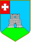
Kremenets
 |
According to some sources the Kremenets fortress was built in the 8th or 9th century, and later became a part of Kievan Rus'. The first documented reference to the fortress is given in a Polish encyclopedic dictionary written in 1064. The first reference to Kremenets in Old Slavic literature dates from 1226 when the city's ruler, Mstislav the Bold, defeated the Hungarian army of King Andrew II nearby. During the Mongol invasion of Rus in 1240–1241, Kremenets was one of few cities that Batu Khan failed to capture. In 1382, after the death of Louis I of Hungary, Lithuanian duke Liubartas captured Kremenets from the Kingdom of Hungary. The city obtained Magdeburg rights in 1431, and in 1569, after the Union of Lublin, it became part of Crown of Poland, known as Krzemieniec.
In the fall of 1648 Cossack Colonel Maxym Kryvonis surrounded the Kremenets fortress. In October, after a six-week siege, the royal garrison surrendered. As a consequence of the fighting, the fortress was severely damaged and was never rebuilt.
In 1795 Kremenets was annexed by the Russian Empire following the Third Partition of the Polish-Lithuanian Commonwealth. It was a town in Kremenetsky Uyezd of the Volhynian Governorate of the Russian Empire until World War I.
During 1917-1920 Kremenets 7 times passed from hand to hand. The authorities Ukrainian state - Ukrainian People's Republic - it was subject to early 1918 to June 1919.
In 1921, following Peace of Riga, the town returned to Poland, and was part of Volhynian Voivodeship (Wołyń).
In the interwar period, Kremenets was famous for its renowned high school, Liceum Krzemienieckie, founded in 1803 by Tadeusz Czacki. According to the 1931 Polish census, the town had a population of 19,877, with 8,428 Ukrainians, 6,904 Jews, 3,108 Poles and 883 Russians. In 1934, upon initiative of Ludwik Gronowski, teacher of the Kremenets High School, Volhynian School of Gliding Sokola Góra (Wołyńska Szkoła Szybowcowa Sokola Góra) was opened 14 kilometers from Kremenets, in the village of Kulików. Among its students was the daughter of Jozef Piłsudski, Jadwiga Piłsudska.
In September 1939, the Polish government was temporarily located in Kremenets, which during this time was subject to heavy aerial bombing until captured by invading Soviet forces on 17 September. By then the government had evacuated Kremenets and was on its way to neutral Romania.
On July 28, 1941, most of the teachers of the Krzemieniec High School were arrested by the Germans, who used a list provided to them by local Ukrainians. By the end of the month, 30 teachers and members of Polish intelligentsia were murdered at the so-called Hill of Crosses (Góra Krzyżów).
In January 1989 the population was 24 570 people.
Map - Kremenets
Map


Country - Ukraine
 |
 |
| Flag of Ukraine | |
During the Middle Ages, Ukraine was the site of early Slavic expansion and the area later became a key centre of East Slavic culture under the state of Kievan Rus', which emerged in the 9th century. The state eventually disintegrated into rival regional powers and was ultimately destroyed by the Mongol invasions of the 13th century. The area was then contested, divided, and ruled by a variety of external powers for the next 600 years, including the Polish–Lithuanian Commonwealth, the Austrian Empire, the Ottoman Empire, and the Tsardom of Russia. The Cossack Hetmanate emerged in central Ukraine in the 17th century, but was partitioned between Russia and Poland, and ultimately absorbed by the Russian Empire. Ukrainian nationalism developed, and following the Russian Revolution in 1917, the short-lived Ukrainian People's Republic was formed. The Bolsheviks consolidated control over much of the former empire and established the Ukrainian Soviet Socialist Republic, which became a constituent republic of the Soviet Union when it was formed in 1922. In the early 1930s, millions of Ukrainians died in the Holodomor, a man-made famine. During World War II, Ukraine was devastated by the German occupation.
Currency / Language
| ISO | Currency | Symbol | Significant figures |
|---|---|---|---|
| UAH | Ukrainian hryvnia | â‚´ | 2 |
| ISO | Language |
|---|---|
| HU | Hungarian language |
| PL | Polish language |
| RU | Russian language |
| UK | Ukrainian language |